Showing posts with label pollen analysis. Show all posts

Wednesday, 4 February 2015

Reconstructing Bronze Age environments at Hobbister, Orkney

by Michelle Farrell (@DrM_Farrell)

Last Monday (2nd February) it was World Wetlands Day, and consequently my Twitter feed was full of stunning photographs of different types of wetland. Much was made of their role in alleviating flooding by acting as giant natural sponges which soak up water, as well as their biodiversity value and ability to store vast amounts of carbon. But despite all the wetland appreciation that I witnessed on Monday, there was very little mention of their importance to archaeologists and palaeoecologists.
Wetlands have a whole archaeological sub-discipline devoted to them. Wetland archaeologists are drawn to these damp, muddy environments because the waterlogged, anaerobic conditions inhibit microbial activity and often result in exceptional preservation of artefacts made from organic materials such as plant fibres, hair, wood and leather. These artefacts rarely survive on dryland sites, meaning that wetlands often preserve an additional level of detail relating to the everyday lives of our ancestors. Wetland archaeological sites also preserve plant and insect remains, which give us insights into the function and economy of the sites. Additionally, wetlands contain an archive of information relating to their own environmental history. Past changes in vegetation can be reconstructed from pollen grains, and the remains of single-celled organisms called testate amoebae provide information about past climates.
Wetlands were also important to people in the past. Across north-west Europe, deposits of precious metalwork were made in both wetland and dryland environments during the Bronze and Iron Ages. Artefacts deposited on dryland tend to be interpreted as valuables that were either lost or hidden with the intention of retrieving them in the future. Given that it would have been difficult to retrieve items from wetlands once they had been deposited, these objects are commonly thought to be votive offerings. In the past wetlands may have been viewed as wilderness and as being resistant to domestication, and it may be that these deposits represent an attempt to appease supernatural powers associated with these environments during times of perceptible environmental change. There is considerable palaeoenvironmental evidence for a shift to a wetter climate during the Bronze Age, particularly in upland regions of Britain. Deposition of valuable metalwork was perhaps an attempt to domesticate and control the changing landscape during this period of wetter climatic conditions.
To date, evaluation of this hypothesis has been hampered by a lack of palaeoenvironmental 
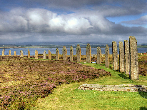
data relating to the findspots of votive deposits - and in many cases, the exact locations of the finds are not recorded. In Orkney in 2006, when I had just begun my PhD research with the aim of reconstructing Bronze Age vegetation and environmental conditions in the islands, peat cutters at Hobbister in Orphir uncovered a beautiful example of a late Bronze Age socketed axehead. Was it a votive deposit, and was there any palaeoenvironmental evidence for changing conditions at the time of deposition? An archaeological survey of the site had revealed various structures interpreted as the remains of a prehistoric field system, as well as several probable Bronze Age burial mounds. The discovery of a potential Bronze Age landscape buried by peat meant that the site would be useful for my PhD research, even if it turned out that I wasn’t able to say much about possible reasons for the axehead deposit.
 
Blanket bog at Hobbister, Orkney

Commercial peat extraction at Hobbister, Orkney

I analysed two peat cores from the site – one from the deepest area of deposits to ensure the fullest possible record was recovered, and one from as close as possible to where the axe was found. Analysis of the peats revealed evidence for a mixed economy based on arable cultivation and livestock rearing. The field system probably formed part of an ‘infield-outfield’ system, where fields nearest to a settlement (‘infields’) were cultivated more or less continuously by adding fertiliser in the form of dung, turf and seaweed, while those beyond (‘outfields’) were only cultivated on a temporary basis, being manured only through the folding of livestock in the summer prior to cultivation. Beyond the outfields would have been common pasture for livestock grazing. At Hobbister the pollen evidence indicates that this would have largely consisted of heathland, and there is evidence from charcoal contained within the peat that this was managed by burning to improve the quality of the grazing by encouraging dense growth of new shoots of heather, which contain more nutrients than old-growth heather, and by allowing grasses to grow in the gaps created by fire.

The remains of plants preserved in the peat at Hobbister suggest that the surface of the bog became slightly wetter during the later Bronze Age, at around 1200-800 BC. If the bog became wetter at this time, it is likely that the surrounding area did too. The suitability of land for farming would have been highly dependent on local hydrology, and increased wetness may have rendered the soil incapable of supporting cereal crops. Although the pollen evidence suggests that cereal cultivation at Hobbister continued at least until the Iron Age, local people would have been extremely aware of the gradual encroachment of peat onto formerly more productive land, and it is distinctly possible that they tried to halt these changes through votive deposition.

Distinctions have been drawn between votive deposits made in different types of wetland, with the suggestion that rivers, with their opposing banks, may have been viewed as boundaries dividing communities, and that deposition here might have been a display of power and prestige to other social groups. Bogs, on the other hand, may have been the focus for ritual acts aimed at reinforcing social cohesion within communities (Fontijn 2002; Mullin 2012). Orkney has no major river systems, but the highly indented coastline may have played a similar role in dividing communities here. Hence the deposition of the Hobbister axe could be seen as an attempt by local people to maintain community integrity during a time of perceptible environmental change.

In summary, wetlands are awesome - they preserve so much information about our past that simply doesn't survive on dryland archaeological sites. Next year on World Wetlands Day, we palaeoecologists and archaeologists need to get in on the act and promote the value of wetlands for understanding our heritage!


References:
Fontijn, D.R. (2002) Sacrificial landscapes: cultural biographies of persons, objects and ‘natural’ places in the Bronze Age of the southern Netherlands, c. 2300-600 BC. Analecta Praehistorica Leidensia 33/34: 1-392 (download for free here)

Mullin, D. (2012) The river has never divided us: Bronze Age metalwork deposition in western Britain. Oxford Journal of Archaeology 31: 47-57

This post is based on my recent paper, available here:

Farrell, M. (in press 2014) Later prehistoric vegetation dynamics and Bronze Age agriculture at Hobbister, Orkney, Scotland. Vegetation History and Archaeobotany. doi: 10.1007/s00334-014-0507-6

Wednesday, 23 July 2014

Searching for palaeoecological clues to the rise and fall of the Maltese Temple Culture

by Michelle Farrell (@DrM_Farrell)

Now, I've done my fair share of the type of fieldwork that Karen recently blogged about here. I've spent long, miserable days with my wellies full of cold, smelly bog water, being tormented by seemingly thousands of midges trapped on the inside of my midge veil. There were actually quite a few sunny days on many of my previous field trips, but in most of the places I worked sudden changes of weather frequently occur, meaning that waterproofs and fleeces could never be left behind. So when I was offered a job as a research fellow on the FRAGSUS project at Queen's University Belfast, I was very excited - not only was it a really interesting project based in a great department, I would get to do fieldwork in Malta. Sunshine! Warmth! No more lugging around a ridiculously heavy rucksack stuffed full of clothing to cover all eventualities of cold/wet/wind/sun/hail/snow/hurricane (perhaps I exaggerate a little).


Fieldwork of the cold, soggy variety in Orkney: cleaning a peat section prior to sampling, and coring at another site

FRAGSUS (Fragility and Sustainability in Restricted Island Environments: Adaptation, Culture Change and Collapse in Prehistory) is a multidisciplinary research project funded by the European Research Council. The project involves archaeologists, palaeoecologists, geoarchaeologists and numerous other specialists, and aims to explore the relationships between changing environments, natural resources and the rise of complex human social systems. We hope to be able to understand more about how and why people invested in the construction of substantial monuments, such as the UNESCO World Heritage status Maltese Temples, in what was presumably a relatively resource-poor, small island environment. It is also hoped that the project will provide insights into the processes, be they socio-economic, environmental, or a combination of factors, that ultimately led to the collapse of the Temple Culture at around 2500 BC.

The Neolithic temples of Ggantija and Mnajdra

My role, working with other palaeoenvironmental specialists, is to reconstruct the past vegetation of the islands via pollen analysis, and to search for evidence of past environmental change and human impact on the environment throughout prehistory. This will be a challenge - pollen is generally best preserved in acidic, wet environments such as peat bogs (hence the reason for all the wet, muddy fieldwork) - and being situated in the Mediterranean and composed almost entirely of limestone, Malta is very dry and alkaline. However, previous work has shown that pollen does survive in Maltese sediments and, more importantly, that the assemblages recovered can be interpretable. I will need to make some adjustments to the methods that I use to process the samples in order to maximise recovery of pollen from them, and I'll need to get used to identifying degraded grains that have not been preserved under optimum conditions. There are also a few new taxa to learn, so I'm looking forward to it!

Several sediment cores had already been recovered by my colleagues before I began work on the project, so my trip to Malta in June this year didn't involve any coring. I had two tasks while I was there. Firstly, I needed to collect samples from various archaeological contexts at the Neolithic settlement site of Tac-Cawla on Gozo, where the archaeological team have been excavating for the last four months. Archaeological pollen samples can often give insights into the ways in which structures were used, and into the range of economic activities that were carried out, so I'm looking forward to getting stuck into those when they arrive back in Belfast at the end of July.

The second aspect of my work in Malta involved collecting modern pollen assemblages in order to aid interpretation of the subfossil assemblages contained within the sediment cores. This was tricky for a number of reasons - firstly, where to sample?! Although it is thought that large areas of Malta were probably once covered with Mediterranean sclerophyllous forest, characterised by Holm Oak and Aleppo Pine, it is doubtful whether any of this remains. Agriculture accounts for 51% of the land area of the Maltese Islands, with urban areas making up a further 22%. The remaining area is made up of small patches of semi-natural vegetation such as maquis, garrigue, and steppe (see here for descriptions of these habitats). Despite the lack of woodland, I still needed to sample these other habitats as they presumably would also have been present in the past. Large enough patches were often difficult to locate, and were usually to be found in remote areas that had somehow escaped cultivation.

Garrigue vegetation with typical agricultural terraces in the background

The second problem to overcome was what to sample as the pollen trap. There are traps specifically designed for the purpose of sampling the modern pollen rain ('Tauber traps'; essentially plastic containers sunk into the ground so that the top is at ground level, with a hole in the lid to allow the pollen rain to be collected). Since there can be large variations in pollen production from year to year due to variations in seasonal temperature and precipitation, at least ten years' worth of data from these traps is required in order to provide an average, and I will only be working on this project for two years. To get around this problem, most researchers doing this type of work in northern Europe would sample a moss polster as these tend to preserve the last few years' worth of pollen rain, but unsurprisingly mosses are not particularly abundant in Malta! I had to sample the top few millimetres of soil (and even soil was hard to come by at some sites) - not ideal from a pollen preservation perspective, but pollen has been known to turn up in some surprising places, so fingers crossed that it will do in this case!

I soon discovered that my dreams of ditching the heavy rucksack were just that - in the intense heat of the Maltese summer, the amount of water that I had to carry with me more than accounted for the weight I'd got rid of by discarding all the cold and wet weather field gear! I had to adjust my fieldwork schedule to cope with the heat - normally I'd get out into the field relatively early, have a brief stop to eat a packed lunch, and then carry on until the work was finished and be 'home' for tea at a reasonably early hour. In Malta I'd be on my way by 7am and work until the heat became unbearable, then take myself and my helpers off for a long lunch and cold drinks in the shade somewhere (one of the advantages of working on small islands is that you're never far from a cafe!) before heading back out for a few hours in the late afternoon/evening. Luckily though, views like the one below and snacks of pastizzi (small pasties containing either cheese or peas, sadly not both together or the temptation to link to a certain Fast Show sketch would be too much) more than made up for any discomfort!


In spite of the challenges and adverse weather conditions, I generally consider fieldwork to be the best part of my job. It usually takes me about a week to recover from a trip and forget about all the problems, and now that I've been back in the lab/office for a couple of weeks, I often find myself wishing I was out in the field again. Unfortunately for me, a few weeks in the field can generate enough lab work and data analysis to keep me going for a year or more, so fieldwork isn't something I get to do an awful lot of! So for now, it's off to the lab to process all the samples I collected, then I'll be spending weeks at the microscope counting several thousand pollen grains...

Thursday, 8 May 2014

How I Got To Be An Academic


by Jane Bunting (@DrMJBunting)

Time for my 'researcher profile', and particularly timely as Jacqueline Gill over at the wonderfully named "Contemplative Mammoth" blog has just announced a call for a blog carnival of posts about people's post-PhD-training careers, whether in academe or elsewhere.  I WILL begin my story with my training, but as I defended my PhD in 1993, it will cover 20 post-training years as well.  I'll try not to go on too long...


I'm currently a senior lecturer in the Department of Geography, Environment and Earth Sciences at the University of Hull.  I'm a palaeoecologist (I study long term ecological systems using the remains of plants and animals preserved in stratigraphic order in lakes and bogs as my 'time machine' to look back and see how things have changed), using mainly pollen analysis, with a particular research interest in the uncertainties and limitations of our methods.  I teach biogeography, environmental change, Quaternary Science and 'skills' type modules, mostly, with a bit of environmental archaeology or landscape history some years.  Being an academic suits me because I like both teaching and research about equally (unless I'm asked the question in Marking Marathon Week).

Pond behind my childhood home (outlined in blue) - googlemaps
As a kid, I liked to know how things work - but not in a taking-apart-and-rebuilding-gadgets way, more in a systems and connections way.  Although I was raised in a really rather dull suburb of Manchester, our identikit suburban semi had an old field pond at the bottom of the garden (one of a series along a recharge zone in the clays in the area).  My parents had thoughtfully made a hedge between the tidier garden and the pond, which gave us kids privacy, and it was our own little bit of wilderness (more mine because my sister was scared of frogs and more averse to getting muddy).  I fell in it (quite a lot), fished creatures and plants out of it and identified them with the aid of a variety of books, made dens of various kinds, dug clay out of the banks and made pots, spent months of summers reading under the willow tree, collected and pressed the wild flowers... muck can be magic! I was also an obsessive reader of anything, history enthusiast, talked a lot, and played 'school' endlessly - I didn't like school, exactly, and liked it less the older I got, but I liked being the teacher and explaining stuff.

 Well into my teens, what I wanted to be when I grew up varied between an explorer, an English eccentric or a part-time hermit (I wanted two social afternoons a week, and a cabin in the hills the rest of the time.  I had it all worked out!).

I dropped Biology as soon as I could at school (didn't like the teacher, didn't want to dissect an eyeball which was the highlight of the next year's syllabus), but did get an O-level in Geography (one of the teachers was gorgeous - oh, the things that shape students' choices at 14!).  I wanted to take History, Latin and Double Maths at A-level, but when that couldn't be accommodated rather grumpily took the more conventional Double Maths, Physics and Chemistry, and realising that I wasn't good enough at maths to be a mathematician (I got A's, but there was a lad in the class who was just So Much Better than me...) applied to university to do natural sciences with a physics focus (my back-up choices were physics courses).  I messed up my first interview at Cambridge royally, was 'pooled' to Newnham College which kindly took me on, and went up in 1987 to study Natural Sciences.  Oh, the joy of a 24/7 library in the building I slept in!  But Physics quickly became my least favourite part of the course, as the theory went fine but the practicals did NOT - electronics and I are not good friends.  I soldered a lot of things together but rarely got anything to work.  I realised that the two topics in physics I most enjoyed in theory, sub-atomic and astronomy, required extensive electronics and optics, so came back for my second year not knowing what to do.  I took theoretical chemistry, history and philosophy of science and botany (chosen on the grounds that you didn't have to cut up animals or remember the names of biochemicals - despite my lack of school biology, the university sent me off with a summer reading list and let me switch), switched to the 'ecology' route in the second term which happened to include one lecture from Professor Richard West on the Quaternary History of the British Flora and that was it - I'd found my academic field.  I spent my final year in the Botany department, did dissertations on a historical topic (my first paper!) and on a pollen record from Star Carr in Yorkshire, got my first and got a NERC 'Framework' PhD studentship to continue in the department working with Dr (now Professor) Keith Bennett (sounds so tidy - hides a LOT of stress, panic, sweat etc. etc.).
http://www.orkneyjar.com/archaeology/2008/08/01/brodgar-excavation-ends-but-the-secrets-of-the-ring-becoming-clearer/
Ring of Brodgar, Orkney - pic from Orkneyjar.

The topic we came up with was the Vegetation History of Orkney, and I spent three mostly happy years visiting one of the most beautiful and addictive places in Britain, reading masses of archaeological and historical literature alongside the palaeoecological stuff, counting challenging pollen samples and learning a huge amount about Geography and Environmental Change (by auditing classes, reading, listening, arguing, going to seminars, volunteering on other people's fieldwork...).  Keith gave me some very good advice on day one: "the chances of you getting an academic job are not zero, but at this point they aren't statistically distinct from zero.  If you get to the end of your PhD, can't get or don't want an academic job, and are starting out in a graduate career three years after your friends, will you regret the time lost?  If so, you should think very seriously about carrying on."  I never expected to be able to carry on after my PhD - I had vague ideas about teaching or accountancy (with a view to working for an environmental charity or the like, since they'd all need to have their books kept) - so I made the most of my chance to do nothing but learn (and row and sing, hobbies are important, but the learning was the point of it all).  At the end of my second year, Keith suggested it might be worth me applying for funding to do a year or two of post-doctoral work.  I liked the idea of spending some time overseas and being a typical near-monoglot Brit wanted to go somewhere English-speaking so contacted a few people in Sweden and Canada.  I put in a few (maybe 4?) applications for funding, then got on with my PhD, thinking of them more as a lottery ticket than a career plan.

Ontario fall
picture borrowed from tourist board web-site - can't find my photo folder!
 But much to my surprise, I got one - and became a NATO Post-Doctoral Fellow at the Wetlands Research Centre, University of Waterloo in Canada, with Professor Barry Warner for the next two years.  In short order, I learnt a lot about sub-zero winters, the importance of air-conditioning in humid summers, coffee shops, TimBits, black flies, bug jackets, the relative lack of slang in Canadian English and teaching in the North American system - oh, and wetlands.  I enjoyed the landscape ('fall' was as amazing as the tourist brochures promised), the people, the wildlife (a chipmunk raised babies just outside our office window, SO CUTE), I missed pubs, people who talked fast and crisps in single-serving packets, and got very frustrated by my project.  A lot of things went wrong and I actually spent about half my time working with surface samples rather than on lakes as planned... in the end that turned out to be a Good Thing, but at the time it was very stressful!
View from the city of Stirling towards the university - a lovely place to live
After two years of that, I came home with a few more papers on the way, spent a few months living at my parents (we all deserve medals for surviving that) and applying for everything that came my way, a six week stint in Sheffield doing some lab work, then got a six month contract at Stirling University on an environmental archaeology related project.  Relocating to Scotland and working on environmental archaeology was exactly what I wanted to do, but the scarcity of jobs was getting me down, even as I began to get some interviews.  Richard Tipping, my boss in Stirling, kindly helped me sort out an unpaid affiliation to the university after my contract ended which gave me a desk, library access etc., and passed little bits of contract work my way when he had them, but I got depressingly familiar with the whole process of signing on, proving you're looking for work every week, applying for housing benefit cycle.  Throughout 1996 and 1997, I applied for post-docs and academic jobs across the UK, and when my first contract in Stirling ended I also developed an exit plan and set myself a timetable for either getting another academic contract or stopping the academic jobhunt altogether.

And then, just like London buses, two jobs came along at once.  I took the one in Hull because it had the longer contract, despite not knowing anything about the place, and I've been here ever since.  Most days, I think that's a good thing!  Palaeoecology definitely lets - nay, encourages! - me to get muddy and to explore how the natural world works, I get to read archaeology and history books and have it count as work, and I get to teach as well.  You'll have to ask my students how I'm doing on the English Eccentric career path... but I don't despair of achieving that goal one day too.

Wednesday, 13 November 2013

Seeing the wood for the trees in Neolithic Orkney

by Michelle Farrell (@DrM_Farrell)

As I mentioned in my first GEES-ology blog post, palynology can be applied, along with a whole host of other scientific techniques, to help answer archaeological questions. One of my main research interests lies in understanding how people interacted with their environments during prehistoric times – not just the ways in which human activities may have impacted upon the environment, but also the effects that environmental conditions may have had on the development of human culture and society. I am particularly interested in how these human-environment relationships may have differed in areas that are currently perceived to be marginal for human settlement, and especially in island environments where finite natural resources would have been available.

To date, my research in this field has focused on the islands of Orkney, situated about 10 km off the northern coast of Scotland. This apparently open, hyper-oceanic environment would presumably have provided quite marginal conditions for human settlement, yet Neolithic communities flourished and the islands contain some of the most spectacular remains of this period in north-west Europe. The importance of these monuments is reflected by the designation of the Heart of Neolithic Orkney World Heritage Site, which includes the settlement of Skara Brae, the chambered tomb of Maeshowe, and the ceremonial sites of the Stones of Stenness and the Ring of Brodgar.


One of the houses at the Neolithic village of Skara Brae,
occupied between about 3200 and 2500 BC
The Stones of Stenness in west Mainland


Berriedale Wood in northern Hoy: Britain's most northerly natural woodland,
and the only patch of native woodland surviving in Orkney today
It has generally been argued that the Neolithic structures of Orkney have survived so well because they were built in stone - the use of stone for construction seems to have been rare elsewhere in Britain at this time. Orkney today is largely treeless – in fact the only natural woodland to be found on the islands is that at Berriedale in northern Hoy, which actually represents the most northerly natural woodland in the British Isles. There is a long-held assumption that Orkney has been devoid of substantial woodland throughout much of the Holocene (the period of time since the end of the last ice age, approximately 11,500 years ago, to the present day). Was the use of stone for construction in Neolithic Orkney therefore an environmental necessity?

Yesnaby in west Mainland serves to demonstrate why the islanders
might have preferred to use flagstone for construction even if plenty of
timber was available! The flagstone easily breaks off along the
bedding planes in perfect, evenly sized slabs ready for building.
Palynological investigations carried out in the 1960s and 70s suggest that Orkney did once have quite extensive tree cover, although high percentages of birch and hazel pollen have led this to be dismissed as ‘scrub’ or ‘shrubland’ rather than true woodland. These studies have often been used to provide context for the Orcadian archaeological record, the story being that the islands were covered with birch-hazel ‘scrub’ during the earlier part of the Holocene, which was then almost entirely cleared for agriculture around 5500 years ago. This apparently forced the islanders to the readily available Orcadian flagstone for their construction materials.

Many of these early palaeoecological studies were hampered by poor dating of the sequences investigated, and when I plotted the dates of woodland decline from previous reliably dated studies, along with dates from new cores that I worked on for my PhD research, it became clear that the timing of woodland decline in Orkney differed between locations. At several sites woodland loss occurred in multiple stages, with fragments of woodland persisting into the Bronze Age in places. So it seems that woodland was present in parts of Orkney throughout the whole of the Neolithic period – but how valuable a resource would it have been to the islanders?

The tendency to dismiss prehistoric Orcadian woodland as ‘scrub’ has led to the assumption that it would not have been particularly valued as a resource by the inhabitants of the islands. Whilst it is true that the woodland was probably largely made up of species such as birch and hazel, even birch-hazel canopied woodland can be a useful and rich resource. In the North Atlantic region, environmental archaeologists have identified the management of birch woodland as one of the most pressing issues in the Norse and medieval periods. The uses of birch wood range from domestic fuel to the production of charcoal for iron smelting, and there is palynological evidence from Greenland that birch woodland was being sustainably managed, indicating the importance of the resource to the human population. In Iceland, woodland was managed by coppicing and access to woodland was controlled by the more powerful members of society. Coppice management of woodland has been practised in Europe since the Mesolithic period (c. 9000-4000 BC), with evidence provided by artefacts such as fish traps found in Ireland and Denmark. There seems to be no reason why the birch-hazel woodland of Orkney should not have been similarly valued for the range of resources that it would have provided. In fact, there may have been greater diversity in some areas, with the possibility that species such as oak and pine also grew on Orkney, and this would only have increased the range of possible uses and value of the resource. More on this in a future blog post!
 
Remains of one of the wooden structures at Braes of Ha'Breck: the large
post holes which would have held the timber uprights are clearly visible
The final question to be answered is whether the woodland of prehistoric Orkney would have been capable of providing timbers that were substantial enough for construction. Until recently, the only early Neolithic settlement known in Orkney was that at Knap of Howar on Papa Westray, which was built in stone at a time when early Neolithic houses elsewhere in Scotland were constructed from timber, thereby apparently supporting the suggestion that the predominance of stone architecture in Neolithic Orkney was a consequence of a lack of timber resources. In recent years early Neolithic buildings have been discovered at several other locations in the islands, with a wide range of architectural styles now recognised from this period. The remains of wooden structures at Wideford in west Mainland and the Braes of Ha’Breck on the island of Wyre clearly demonstrate that timber resources were exploited during the earlier part of the Orcadian Neolithic. Whilst it is probable that at least some of this timber was derived from driftwood, recent palynological evidence has shown that local woodland could have provided a more reliable resource. The archaeological evidence from Braes of Ha’Breck suggests that whilst in some cases timber buildings were directly replaced with stone structures, others may have been contemporary with them. Although stone buildings appear to have been predominant in the later phases of occupation at this site, large structural timbers continued to be used within them. A small domestic quarry on the site appears to have been exploited for its stone during the early Neolithic, when buildings were being constructed from wood, and was apparently filled in and no longer used during the later Neolithic, at a time when it has been suggested that people were turning to flagstone as a substitute for timber. This was also a period of rapid social change, and the combination of palynological and archaeological evidence suggests that the shift from timber to stone construction in the mid 4th millennium BC in Orkney can no longer be explained simply as a consequence of a lack of timber resources. Rather than being an environmental necessity, it more likely reflects underlying social and cultural changes. 

This blog post is based on the following article, which can be accessed here:

Farrell, M., Bunting, M.J., Thomas, A. and Lee, D. (in press) Neolithic settlement at the woodland’s edge: palynological data and timber architecture in Orkney, Scotland. Journal of Archaeological Science (2012), doi:10.1016/j.jas.2012.05.042.


Wednesday, 14 August 2013

Vegetation survey in sunny Spain

by Michelle Farrell (@DrM_Farrell)


In my last blog post a few weeks ago, I gave a brief introduction to the science of palynology, or pollen analysis. Essentially, palynologists analyse the pollen grains preserved in ‘environmental archives’ such as peat bogs or lakes where sediments have accumulated in order to build up a picture of how the surrounding vegetation has changed over time. However, the interpretation of these pollen assemblages is far from straightforward, since pollen grains from different species vary in terms of size, shape and therefore dispersability, and there are also differences in the amount of pollen per unit plant produced by different species due to variation in plant reproductive strategies. For example, wind-pollinated plants need to produce much greater amounts of pollen than insect-pollinated species in order to increase their chances of reproductive success.
 
A key goal since the earliest days of palynology has been the quantitative reconstruction of past vegetation abundance from pollen assemblages. Models of pollen dispersal and deposition have now been developed, and estimation of Relative Pollen Productivity (RPP) is an essential for applying these models to reconstruction of vegetation from pollen records. Empirical estimates of RPP can be extracted from measurements of modern pollen assemblages and vegetation cover, and over the last 10-15 years considerable research effort has been invested in obtaining RPP estimates for key taxa. A recent review reported a wide range of RPP values for individual pollen taxa from different studies across Europe (Broström et al. 2008)‚ but since a standard methodology was not used to record vegetation cover it is not possible to determine whether these differences are due to variation in taxonomic groups (pollen grains can often only be identified to family or genus level, so in different regions a different assemblage of species may make up the palynological equivalent taxon Betula or Poaceae)‚ variations in environmental factors between study sites (e.g. climate‚ management)‚ or reflect the variations in methodology (Bunting and Hjelle 2010).

In May 2010, we held a workshop at the University of Hull which brought together several key researchers in the field of quantitative vegetation reconstruction from pollen records. At this workshop we came up with a standardised method of vegetation survey for obtaining RPP estimates. As part of the Crackles Bequest Project Jane Bunting and I, along with a team of European project partners, have applied this method to compare estimates of RPP within individual species across a wide climatic range and in different habitats. We’ll write more about the results of this project in future blog posts.

The majority of researchers who are interested in using models of pollen dispersal and deposition to quantitatively reconstruct past vegetation cover are based in north-west Europe, and as a result this is where most research activity to date has been focussed. The approach is now beginning to be adopted worldwide, and we are now collaborating with groups working in India, South Africa and South America to obtain estimates of RPP for common taxa in their regions. A little closer to home, research groups based in southern Europe are using the standardised vegetation survey protocol developed for the Crackles Bequest Project to taxa of interest for reconstructing Mediterranean environments. 

In June 2013 I was invited to join a team from the Pyrenean Institute of Ecology in Zaragoza, Spain on their fieldwork near the town of Teruel in the east of the country. Their research project is focused on the palaeolake at Villarquemado, from which they have recovered a 74m long sequence for pollen analysis. The group are now working towards estimating RPP for six key taxa in this sequence to enable them to quantitatively reconstruct the former vegetation in this area. I joined the group for a week to demonstrate the standardised vegetation survey methodology and to learn more about their research.

The palaeolake at Villarquemado, now mostly infilled and supporting fen-type vegetation

After a false start (I arrived at Leeds-Bradford airport on the day I was due to fly to Barcelona to find that all flights were cancelled due to a French air traffic control strike!), I eventually arrived in Zaragoza two days later than originally planned. I was met at the railway station in Zaragoza by my colleague’s husband, and we then drove for approximately two hours to the village that we would be staying in. Incidentally, if anyone is planning a holiday in this region you could do worse than to stay at the house we rented for the week – it was absolutely beautiful!

The following day we made an early start to avoid the worst of the heat (although I have to say that 30oC was still a bit of a shock to my system, coming as I had straight from the miserable British summer that we had been having at that point!) and headed to one of the group's sampling locations. There are some differences between working in north-west Europe and in the Mediterranean region - for example in our fieldwork areas we normally collect a moss polster as our pollen 'trap', but since moss is pretty hard to come by in semi-arid Mediterranean environments 'Tauber traps' had to be used by the Spanish research group. These are essentially plastic containers sunk into the ground so that the top is at ground level, with a hole in the lid to allow the pollen rain to be collected. The team will return to empty the traps at the end of the flowering season to ensure that a full year of pollen rain is collected, so for now our task was to survey the surrounding vegetation.
 
The view from one of our sampling sites - very different to the lush green landscapes that I am used to working in in north-west Europe. Although I'm told that this is an unusually wet year and that everything is much more green than usual...

View from another sampling site, with the Tauber trap visible in the foreground
Once we had all got to grips with the intricacies of the survey method, the team worked incredibly efficiently, and we managed to survey all 12 sites in five days. We also had fantastic logistical support from the husbands of two members of the survey team, who arrived to meet us every lunch time with hampers full of goodies to fuel us through the afternoon! For me, there were huge benefits to joining my Spanish colleagues for a week – I got to know people that I had previously met only at conferences much better, I made new friends, I got to experience fieldwork in a totally different environment to that which I am used to working in, and I learned a lot about Mediterranean plants and environments. I’m really looking forward to seeing the results once Edu has processed all the pollen and vegetation data from this field season!

Wednesday, 17 July 2013

Palynology: why pollen is not to be sniffed at!

by Michelle Farrell (@DrM_Farrell)

To around 20% of the UK population, pollen is familiar as the cause of hay fever during the spring and summer months. To a very small minority (ironically, many of them well acquainted with the runny-nosed, itchy-eyed symptoms of hay fever themselves), pollen is much more than an allergen. Pollen grains contain the male gametophyte of seed-producing plants, and in order to increase their chances of reproductive success, wind-pollinated plants produce pollen in vast quantities. The small size of pollen grains (generally in the order of 20 to 40 microns, a micron being one thousandth of a millimetre) means that when they are released by a plant they become widely dispersed in the environment. As the plant has no control over where its pollen grains end up, another part of the reproductive strategy is that the grains have a very tough outer casing or exine, made of a substance called sporopollenin, allowing them to survive in less than perfect conditions. This outer wall can be preserved in several environments, particularly waterlogged ones, for tens of thousands of years. This combination of pollen being produced in large quantities, wide dispersal in the environment, excellent preservation under the right conditions, and the fact that pollen grains can often be identified to family, genus and even species level, is what makes them such a valuable tool for research.  

Coring to retrieve pollen-bearing sediments from a bog
on Orkney, Scotland
Pollen analysis is one of the most common methods used for investigating past environments. Pollen is often preserved in waterlogged environments where sediments accumulate, such as lakes and peat bogs. Cores of sediment can be extracted from these locations, and sub-samples from various depths are then subjected to a series of physical and chemical laboratory treatments which remove the majority of the inorganic sediments and large organic debris, leaving behind the fine organic fraction of the sediment. It is this fraction that contains the pollen grains, as well as other tiny organic remains including fern and fungal spores, other fungal remains such as hyphae, and fragments of charcoal from either natural or anthropogenic fires. The study of all these remains together is known as palynology, a term coined by the British scientists Hyde and Williams in 1944 and derived from Greek words meaning ‘the study of small particles sprinkled about’.

The stripes in this core segment indicate that the sediments
were deposited under different environmental conditions
Once you have concentrated the fine organic fraction of the sediment, the next stage is to identify the botanical remains contained within it. Much as a botanist would use a key to help them to identify plants out in the field, palynologists use keys to pollen and spores to aid their identification of specimens under the microscope in the lab. The identification and study of fungal remains is still a relatively new technique, and to date no definitive key to these types of remains has been published. Therefore I’ll focus here on the distinctive characteristics of pollen grains that allow palynologists to distinguish between the different taxa present in a sample. One of the most distinctive features of pollen grains is their apertures. There are two types of aperture: pori (pores), roughly spherical in shape, and colpi (furrows), which are elongated and have pointed ends. Some grains have both colpi and pori in the same apertures, and are known as colporate. The number and arrangement of the apertures is also key in pollen identification. The number of apertures is indicated by the use of the prefixes mono-, di-, tri-, tetra-, penta- and hexa- before the terms porate, colpate and colporate. The prefix poly- is used to denote the presence of more than six apertures. Usually the apertures are arranged equidistantly around the equator of the pollen grain, and this is indicated by the prefix zono-. Panto- is used when the apertures are scattered all over the surface of the grain. Some examples of the way in which apertures are used to identify pollen grains are shown below.

Betula (birch) pollen: trizonoporate,
with three pores arranged equidistantly
 around the equator of the grain
Fraxinus excelsior (common ash) pollen:
trizonocolpate, with three furrows arranged
equidistantly around the equator of the grain


Rumex obtusifolius (broad-leaved dock):
tetrazonocolporate, with four apertures
made up of both colpi and pori
Plantago lanceolata (ribwort plantain):
polypantoporate, with many pores scattered
all over the surface of the grain


The pattern of sculpturing found on the surface of the exine is another crucial factor in the identification of pollen grains. Around fifteen different surface patterns have been described, and two of the more distinctive patterns are shown in the images below.

Cirsium arvense (creeping thistle) pollen, a
good example of echinate surface sculpture


Ulmus (elm) pollen, displaying rugulate
surface sculpturing


Size can also be important in distinguishing between pollen taxa, particularly members of the grass family. The two images below show the difference in size between a wild grass, Phragmites australis (common reed) and a cultivated grass, Triticum aestivum (wheat).

Phragmites australis (common reed) pollen
Triticum aestivum (wheat) pollen


The identification and recording of pollen grains from different depths within a sediment core can be used to provide information on how the vegetation surrounding the core site has changed over time. Sediment cores can often be accurately dated using radiocarbon, allowing the changes in environment to be tied to a chronology. Palynology has great potential for providing baseline data for the development of conservation management strategies, and is also useful from an ecological perspective as it can give insights into how plant communities have responded to climate change in the past, thereby allowing predictions to be made about how vegetation and ecosystems may be affected by future climate change.

One of my main research interests is in the use of palynology as a tool to unpick the ways in which humans interacted with their environments during the Holocene (the period since the end of the last ice age, approximately 11,500 years ago, until the present day). I intend to write more about the archaeological applications of palynology in future posts, but as a taster, it is possible to determine when people began farming in an area, what crops they were growing, where they grazed their animals, whether they cleared woodland to create more land for agriculture, and how they contributed to the development of cultural landscapes such as heathlands. It is also possible to investigate the ways in which people may have managed their environments and responded to climate change in the past, for example managing heathland by deliberate burning in order to maintain the quality of grazing. It may even be possible to detect woodland management practices such as coppicing, and Jane Bunting will write about her work on this in the next GEES-ology post.