Showing posts with label archaeology. Show all posts

Wednesday, 17 August 2016

Earthquakes and architecture – ancient and modern in Peru

By Lindsey Atkinson

Peru lies on the western side of South America: approximately 100 miles off the coast in the Pacific Ocean the Nazca plate is subducted under the South American plate forming the Peru-Chile (Atacama) Trench.  As a result Peru is subject to frequent earthquakes* and sometimes even tsunamis (e.g. 1996 and 2001). 

Adobe house
 Approximately two-thirds of Peru’s rural population live in adobe dwellings which are particularly vulnerable to collapse during an earthquake.  Adobes are made out of sun-baked clay bricks and it is only possible to build up to two floors.  Professor Marcial Blondet and his team at the Catholic University of Peru in Lima have been working to make adobe buildings safer (http://news.bbc.co.uk/1/hi/world/americas/8202498.stm) using a polymer mesh for reinforcement.  They recommend keeping buildings to one storey and keeping the size of openings to a minimum for greater strength. Today although people in rural areas still build their own adobe houses, in many towns most buildings are now constructed with steel reinforced concrete which allows for much taller structures.

Huaca Pucllana
How did ancient Peruvians cope with earthquakes without the benefits of modern technology?  The temple of Huaca Pucllana in Lima (http://huacapucllanamiraflores.pe/) was built by the Lima culture between 200 and 500 AD and is an adobe ‘pyramid’.   This mud structure, now partially reconstructed, has survived so long, partly due to the extremely low rainfall in the region, but also because of its construction with bricks placed vertically and spaced to allow for movement during earthquakes.

The Incas (1200-1542 AD) built with stone.  For example the temple of Qorikancha in Cusco (https://www.cuscoperu.com/en/travel/cusco/archaeological-centers/qorikancha) demonstrates fine masonry with large, well–fitting, rectangular blocks of stone.  No mortar was used, but a fine layer of sand between blocks allows for some movement during an earthquake.  The structure has inward sloping walls which provide stability and it is said that the trapezoid niches and doorways help dissipate the energy of seismic tremors.  Sites such as Sacsayhuaman near Cusco have well-fitting, but this time, irregular shaped blocks.  This degree of craftsmanship seems to have been reserved for religious sites and for the nobility: other sites have rougher stonework with mud mortar and square niches.  

Sacsayhuaman
Qorikancha


Lima Cathedral
The Spanish colonial builders were not so successful: many of their buildings collapsed during earthquakes, while Inca structures remained. For example, the convent of Santo Domingo in Cusco was built on top of Qorikancha, using the temple as its foundations but while the convent had to be rebuilt following the 1950 earthquake the Inca walls stood undamaged.  The cathedral in Lima dates from 1535 but has suffered damage following many earthquakes and in 1746 it was completely flattened.  The current building has wooden, rather than stone, columns and a wooden ceiling plus a policy of strictly no candles!  However, the catacombs beneath the nearby Monastery of Saint Francis, built of bricks and mortar, do seem to have survived quite well.  These crypts also include well-shaped structures which again are said to dissipate the lateral energy of a tremor.

Probably the most famous site in Peru is the citadel of Machu Picchu, abandoned shortly after the Spanish Conquest in the mid-1500s: one theory is that this was to prevent it from being found by the Spanish.  It remained hidden to all but local farmers until 1911 when it was rediscovered by the American explorer, Hiram Bingham.  The ability of these structures to withstand earthquakes is largely anecdotal and have not been proven, although modern techniques allow for better assessment of their earthquake protection properties (see Cuadra et al. 2008). So far Machu Picchu has proved to be remarkably earthquake resistant.

Machu Picchu


*Most recently on 15.08.16 (http://www.bbc.co.uk/news/world-latin-america-37084723)

Bibliography
Bankoff G. 2015. Seismic architecture and cultural adaptation to earthquakes. In: Krüger F, Bankoff G, Cannon T, Orlowski B, and Schipper L, eds. Cultures and disasters: Understanding cultural framings in disaster risk reduction. New York and London: Routledge.
Blondet M, Villa Garcia GM and Brzev S2003. Earthquake-Resistant Construction of Adobe Buildings: A Tutorial. Published as a contribution to the EERI/IAEE World Housing Encyclopedia, http://www.world-housing.net/wp-content/uploads/2011/06/Adobe_Tutorial_English_Blondet.pdf
Cuadra C, Karkee MB and Tokeshi K. 2008. Earthquake risk to Inca’s historical constructions in Machupicchu. Adv. Eng. Software 39: 336-345. http://dx.doi.org/10.1016/j.advengsoft.2007.01.002.
Smith J and Petley DN. 2007. Environmental hazards: assessing risk and reducing disaster. 5th edn.  New York: Routledge.
Stewart A. 2013. The Inca Trail, Cusco and Machu Picchu. 5th edn. Trailblazer Publications. Surrey, UK

Wednesday, 9 July 2014

How I became a historical geographer

By Briony McDonagh (@BrionyMcDonagh
Hi all! This is the latest blog in our series about how we came to do what we do. My name's Briony and I'm a lecturer in human geography here at GEES in Hull. My research interests lie in historical and cultural geography, and I’m particularly interested in how issues of power, space, identity and gender have been played out in the British landscape over the last 1000 years.


Like many of my colleagues I certainly didn't know I wanted to be an academic as a child, but I did like old and ruined buildings, Time Team and trying to figure out why the landscape looked like it did. My friends and I spent considerable amounts of time exploring an abandoned group of farm buildings not far from school (below), which it later turned out were 16th century in date and built from the ruins of a medieval monastery. For some reason I've long ago forgotten, I chose not to take History at GCSE, but ended up taking  a combination of A-level subjects which included both Geography and Classics. I applied for degree courses in a range of subjects but finally settled on a BA hons in Geography at University of Nottingham with the intention of applying for the Foreign and Commonwealth Office when I left.


Haltemprice Priory Farm © Mr Gareth Parry LRPS
That didn't happen, of course, principally because I got bitten by the research bug. I took second year courses which included classes on ancient woodlands, urban histories and the mappa mundi and third year modules which involved fieldwork on Italian environmental histories and the urban plan of Revolutionary Paris, along with archival work in the University of Nottingham's Manuscripts and Special Collections. I was hooked. I chose to stay at Nottingham to complete a Masters in Landscape and Culture – which included training in standing buildings and landscape archaeology – followed by 3 years writing a PhD on the historical geographies of the Yorkshire Wolds before c. 1600. It was during this time I developed my current interdisciplinary approach to the landscape combining documentary research, maps, landscape archaeology and theoretical perspectives drawn from cultural geography and elsewhere.
The day I submitted by PhD I was offered a job with the Victoria County History contributing to a volume on the history of Howden and the surrounding region. I did this for 7 months before securing a longer-term post-doctoral position working on an AHRC-funded project researching the long-term impacts of parliamentary enclosure on the landscapes and communities of Northamptonshire (you can find out more about the project here). As part of my post, I also taught in the History department at the University of Hertfordshire, teaching a second year social history course and a third year module on the history of the English landscape, something I absolutely loved doing. Whilst working through endless boxes of archival materials at the Northamptonshire Record Office I came across Elizabeth Prowse, a committed agricultural improver who radically remodelled her estate during her 43-year widowhood (for more on Prowse, see my chapter on her here). It was as a result of researching and writing about Prowse that I began to wonder about the contribution made by other elite women to managing and improving landed estates in Georgian England. We know many male landowners pushed forward enclosure and introduced agricultural improvements on their estates, but we know almost nothing about the part female landowners played in the changes which transformed the English landscape in the century after about 1730. Women certainly owned property as widows and heiresses and sometimes even wives, but how involved were they in its management and improvement?


Wicken House (Northamptonshire), the home of Elizabeth Prowse
These are the questions that my current research project sets out to answer. Whilst still working as a post-doc in 2009, I secured a Leverhulme Trust Early Career Fellowship for the project which I then undertook at the University of Nottingham between 2010 and 2014 (the end date for the project was twice extended as a result of the arrival of two little people in my life). Running my own project was a great experience and I later managed to secure additional funding from the Arts and Humanities Research Council to write a book from the project. I transferred this grant to the University of Hull when I took up my post here in early 2014, and I’m now about halfway through writing up the book (to be published by Ashgate, hopefully in 2015).
So after almost 7 years of post-doctoral and fixed term posts, I finally have a permanent job. I have to admit that when I was completing my PhD, I never imagined I would spend quite so many years in post-doctoral positions. But those 7 years have given me the real luxury of being able to conduct a huge amount of research on a wide range of topics. In addition to my book on elite women, I'm currently working on projects on late medieval popular geographical imaginations, early modern anti-enclosure protest (see, for example, https://hull.academia.edu/BrionyMcDonagh) and the land rights movement in the 21st century (you can listen to me talk about the latter project here). I'm hoping having got all this research under my belt will stand me in good stead in my new job given all the demands on my time that a larger teaching role and increased departmental administration are likely to bring. All in, I’ve certainly got plenty to keep me busy for the next 7 years! 

Wednesday, 13 November 2013

Seeing the wood for the trees in Neolithic Orkney

by Michelle Farrell (@DrM_Farrell)

As I mentioned in my first GEES-ology blog post, palynology can be applied, along with a whole host of other scientific techniques, to help answer archaeological questions. One of my main research interests lies in understanding how people interacted with their environments during prehistoric times – not just the ways in which human activities may have impacted upon the environment, but also the effects that environmental conditions may have had on the development of human culture and society. I am particularly interested in how these human-environment relationships may have differed in areas that are currently perceived to be marginal for human settlement, and especially in island environments where finite natural resources would have been available.

To date, my research in this field has focused on the islands of Orkney, situated about 10 km off the northern coast of Scotland. This apparently open, hyper-oceanic environment would presumably have provided quite marginal conditions for human settlement, yet Neolithic communities flourished and the islands contain some of the most spectacular remains of this period in north-west Europe. The importance of 
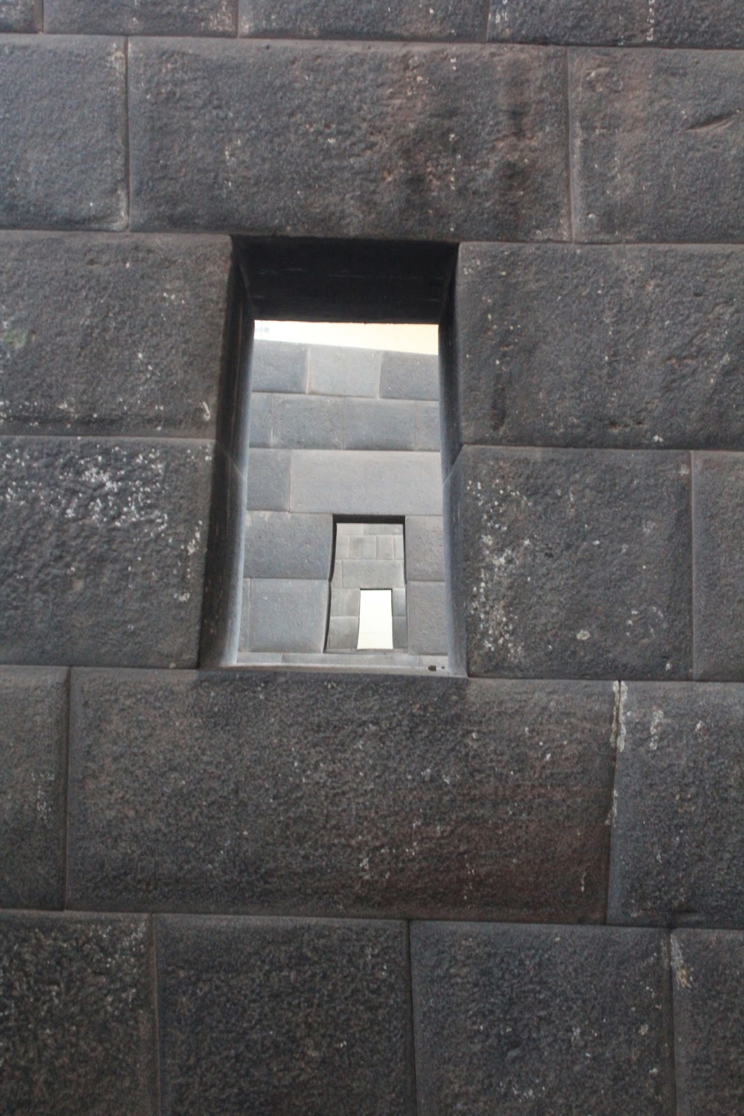
these monuments is reflected by the designation of the Heart of Neolithic Orkney World Heritage Site, which includes the settlement of Skara Brae, the chambered tomb of Maeshowe, and the ceremonial sites of the Stones of Stenness and the Ring of Brodgar.


One of the houses at the Neolithic village of Skara Brae,
occupied between about 3200 and 2500 BC
The Stones of Stenness in west Mainland


Berriedale Wood in northern Hoy: Britain's most northerly natural woodland,
and the only patch of native woodland surviving in Orkney today
It has generally been argued that the Neolithic structures of Orkney have survived so well because they were built in stone - the use of stone for construction seems to have been rare elsewhere in Britain at this time. Orkney today is largely treeless – in fact the only natural woodland to be found on the islands is that at Berriedale in northern Hoy, which actually represents the most northerly natural woodland in the British Isles. There is a long-held assumption that Orkney has been devoid of substantial woodland throughout much of the Holocene (the period of time since the end of the last ice age, approximately 11,500 years ago, to the present day). Was the use of stone for construction in Neolithic Orkney therefore an environmental necessity?

Yesnaby in west Mainland serves to demonstrate why the islanders
might have preferred to use flagstone for construction even if plenty of
timber was available! The flagstone easily breaks off along the
bedding planes in perfect, evenly sized slabs ready for building.
Palynological investigations carried out in the 1960s and 70s suggest that Orkney did once have quite extensive tree cover, although high percentages of birch and hazel pollen have led this to be dismissed as ‘scrub’ or ‘shrubland’ rather than true woodland. These studies have often been used to provide context for the Orcadian archaeological record, the story being that the islands were covered with birch-hazel ‘scrub’ during the earlier part of the Holocene, which was then almost entirely cleared for agriculture around 5500 years ago. This apparently forced the islanders to the readily available Orcadian flagstone for their construction materials.

Many of these early palaeoecological studies were hampered by poor dating of the sequences investigated, and when I plotted the dates of woodland decline from previous reliably dated studies, along with dates from new cores that I worked on for my PhD research, it became clear that the timing of woodland decline in Orkney differed between locations. At several sites woodland loss occurred in multiple stages, with fragments of woodland persisting into the Bronze Age in places. So it seems that woodland was present in parts of Orkney throughout the whole of the Neolithic period – but how valuable a resource would it have been to the islanders?

The tendency to dismiss prehistoric Orcadian woodland as ‘scrub’ has led to the assumption that it would not have been particularly valued as a resource by the inhabitants of the islands. Whilst it is true that the woodland was probably largely made up of species such as birch and hazel, even birch-hazel canopied woodland can be a useful and rich resource. In the North Atlantic region, environmental archaeologists have identified the management of birch woodland as one of the most pressing issues in the Norse and medieval periods. The uses of birch wood range from domestic fuel to the production of charcoal for iron smelting, and there is palynological evidence from Greenland that birch woodland was being sustainably managed, indicating the importance of the resource to the human population. In Iceland, woodland was managed by coppicing and access to woodland was controlled by the more powerful members of society. Coppice management of woodland has been practised in Europe since the Mesolithic period (c. 9000-4000 BC), with evidence provided by artefacts such as fish traps found in Ireland and Denmark. There seems to be no reason why the birch-hazel woodland of Orkney should not have been similarly valued for the range of resources that it would have provided. In fact, there may have been greater diversity in some areas, with the possibility that species such as oak and pine also grew on Orkney, and this would only have increased the range of possible uses and value of the resource. More on this in a future blog post!
 
Remains of one of the wooden structures at Braes of Ha'Breck: the large
post holes which would have held the timber uprights are clearly visible
The final question to be answered is whether the woodland of prehistoric Orkney would have been capable of providing timbers that were substantial enough for construction. Until recently, the only early Neolithic settlement known in Orkney was that at Knap of Howar on Papa Westray, which was built in stone at a time when early Neolithic houses elsewhere in Scotland were constructed from timber, thereby apparently supporting the suggestion that the predominance of stone architecture in Neolithic Orkney was a consequence of a lack of timber resources. In recent years early Neolithic buildings have been discovered at several other locations in the islands, with a wide range of architectural styles now recognised from this period. The remains of wooden structures at Wideford in west Mainland and the Braes of Ha’Breck on the island of Wyre clearly demonstrate that timber resources were exploited during the earlier part of the Orcadian Neolithic. Whilst it is probable that at least some of this timber was derived from driftwood, recent palynological evidence has shown that local woodland could have provided a more reliable resource. The archaeological evidence from Braes of Ha’Breck suggests that whilst in some cases timber buildings were directly replaced with stone structures, others may have been contemporary with them. Although stone buildings appear to have been predominant in the later phases of occupation at this site, large structural timbers continued to be used within them. A small domestic quarry on the site appears to have been exploited for its stone during the early Neolithic, when buildings were being constructed from wood, and was apparently filled in and no longer used during the later Neolithic, at a time when it has been suggested that people were turning to flagstone as a substitute for timber. This was also a period of rapid social change, and the combination of palynological and archaeological evidence suggests that the shift from timber to stone construction in the mid 4th millennium BC in Orkney can no longer be explained simply as a consequence of a lack of timber resources. Rather than being an environmental necessity, it more likely reflects underlying social and cultural changes. 

This blog post is based on the following article, which can be accessed here:

Farrell, M., Bunting, M.J., Thomas, A. and Lee, D. (in press) Neolithic settlement at the woodland’s edge: palynological data and timber architecture in Orkney, Scotland. Journal of Archaeological Science (2012), doi:10.1016/j.jas.2012.05.042.


Wednesday, 17 July 2013

Palynology: why pollen is not to be sniffed at!

by Michelle Farrell (@DrM_Farrell)

To around 20% of the UK population, pollen is familiar as the cause of hay fever during the spring and summer months. To a very small minority (ironically, many of them well acquainted with the runny-nosed, itchy-eyed symptoms of hay fever themselves), pollen is much more than an allergen. Pollen grains contain the male gametophyte of seed-producing plants, and in order to increase their chances of reproductive success, wind-pollinated plants produce pollen in vast quantities. The small size of pollen grains (generally in the order of 20 to 40 microns, a micron being one thousandth of a millimetre) means that when they are released by a plant they become widely dispersed in the environment. As the plant has no control over where its pollen grains end up, another part of the reproductive strategy is that the grains have a very tough outer casing or exine, made of a substance called sporopollenin, allowing them to survive in less than perfect conditions. This outer wall can be preserved in several environments, particularly waterlogged ones, for tens of thousands of years. This combination of pollen being produced in large quantities, wide dispersal in the environment, excellent preservation under the right conditions, and the fact that pollen grains can often be identified to family, genus and even species level, is what makes them such a valuable tool for research.  

Coring to retrieve pollen-bearing sediments from a bog
on Orkney, Scotland
Pollen analysis is one of the most common methods used for investigating past environments. Pollen is often preserved in waterlogged environments where sediments accumulate, such as lakes and peat bogs. Cores of sediment can be extracted from these locations, and sub-samples from various depths are then subjected to a series of physical and chemical laboratory treatments which remove the majority of the inorganic sediments and large organic debris, leaving behind the fine organic fraction of the sediment. It is this fraction that contains the pollen grains, as well as other tiny organic remains including fern and fungal spores, other fungal remains such as hyphae, and fragments of charcoal from either natural or anthropogenic fires. The study of all these remains together is known as palynology, a term coined by the British scientists Hyde and Williams in 1944 and derived from Greek words meaning ‘the study of small particles sprinkled about’.

The stripes in this core segment indicate that the sediments
were deposited under different environmental conditions
Once you have concentrated the fine organic fraction of the sediment, the next stage is to identify the botanical remains contained within it. Much as a botanist would use a key to help them to identify plants out in the field, palynologists use keys to pollen and spores to aid their identification of specimens under the microscope in the lab. The identification and study of fungal remains is still a relatively new technique, and to date no definitive key to these types of remains has been published. Therefore I’ll focus here on the distinctive characteristics of pollen grains that allow palynologists to distinguish between the different taxa present in a sample. One of the most distinctive features of pollen grains is their apertures. There are two types of aperture: pori (pores), roughly spherical in shape, and colpi (furrows), which are elongated and have pointed ends. Some grains have both colpi and pori in the same apertures, and are known as colporate. The number and arrangement of the apertures is also key in pollen identification. The number of apertures is indicated by the use of the prefixes mono-, di-, tri-, tetra-, penta- and hexa- before the terms porate, colpate and colporate. The prefix poly- is used to denote the presence of more than six apertures. Usually the apertures are arranged equidistantly around the equator of the pollen grain, and this is indicated by the prefix zono-. Panto- is used when the apertures are scattered all over the surface of the grain. Some examples of the way in which apertures are used to identify pollen grains are shown below.

Betula (birch) pollen: trizonoporate,
with three pores arranged equidistantly
 around the equator of the grain
Fraxinus excelsior (common ash) pollen:
trizonocolpate, with three furrows arranged
equidistantly around the equator of the grain


Rumex obtusifolius (broad-leaved dock):
tetrazonocolporate, with four apertures
made up of both colpi and pori
Plantago lanceolata (ribwort plantain):
polypantoporate, with many pores scattered
all over the surface of the grain


The pattern of sculpturing found on the surface of the exine is another crucial factor in the identification of pollen grains. Around fifteen different surface patterns have been described, and two of the more distinctive patterns are shown in the images below.

Cirsium arvense (creeping thistle) pollen, a
good example of echinate surface sculpture


Ulmus (elm) pollen, displaying rugulate
surface sculpturing


Size can also be important in distinguishing between pollen taxa, particularly members of the grass family. The two images below show the difference in size between a wild grass, Phragmites australis (common reed) and a cultivated grass, Triticum aestivum (wheat).

Phragmites australis (common reed) pollen
Triticum aestivum (wheat) pollen


The identification and recording of pollen grains from different depths within a sediment core can be used to provide information on how the vegetation surrounding the core site has changed over time. Sediment cores can often be accurately dated using radiocarbon, allowing the changes in environment to be tied to a chronology. Palynology has great potential for providing baseline data for the development of conservation management strategies, and is also useful from an ecological perspective as it can give insights into how plant communities have responded to climate change in the past, thereby allowing predictions to be made about how vegetation and ecosystems may be affected by future climate change.

One of my main research interests is in the use of palynology as a tool to unpick the ways in which humans interacted with their environments during the Holocene (the period since the end of the last ice age, approximately 11,500 years ago, until the present day). I intend to write more about the archaeological applications of palynology in future posts, but as a taster, it is possible to determine when people began farming in an area, what crops they were growing, where they grazed their animals, whether they cleared woodland to create more land for agriculture, and how they contributed to the development of cultural landscapes such as heathlands. It is also possible to investigate the ways in which people may have managed their environments and responded to climate change in the past, for example managing heathland by deliberate burning in order to maintain the quality of grazing. It may even be possible to detect woodland management practices such as coppicing, and Jane Bunting will write about her work on this in the next GEES-ology post.