Thursday, 12 March 2015

WOW Week of Women in GEES: Lois Latham (1910-1990), regional geographer

by Briony McDonagh (with help from Helen Manning)

Today’s ‘WOW GEES woman’ is Lois Latham, a regional geographer who spent more than 30 years in the Department of Geography here at Hull. She was the first woman to be appointed to a permanent academic post in the department in 1946 and throughout much of her tenure, the only female academic working in the department.


Lois Latham with colleagues at a retirement function in 1989
(l-r: Jay Appleton, Alan Harris, Harry Wilkinson, Lois Latham and George de Boer) 

Latham was born more than a century ago, in Wakefield (West Yorkshire) in 1910, later studying geography at the University of Sheffield and graduating in or around 1932. She served as editor of the Scottish Geographical Magazine between 1936 and 1940 – the third woman in succession to hold the post – and during the Second World War, she contributed to the Admiralty Intelligence Handbooks.

In 1946, she moved to Yorkshire, appointed as a lecturer in Geography in what was then Hull University College. This was a time when the city was still hard hit by its aerial bombardment during the War. As a then colleague of Latham’s in the Department of Economics mentioned to me recently, Hull in the late 1940s and early 1950s was badly ravaged by war with thousands of bombed-out houses and many of the academics at the University working out of army huts!

During her more than 30 years at Hull, Latham was active in the teaching programme and in a range of other roles both within and beyond the University. She was President of the Hull branch of the Geographical Association from 1954 until around 1960 when she handed over the presidency to her colleague in the department George de Boer. She travelled widely and in 1959 to 1960 she spent a year at the University of Zagreb in Yugoslavia and later organised a return visit to Hull by Tomislav Ĺ egota of the Yugoslav Encyclopaedia, an international connection linked closely to her own research interests in the regional geography of the USSR. She also headed the department’s contribution to the second phase of the Land Utilisation Survey of Britain, the behemoth of a mapping project first initiated by Dudley Stamp in the early 1930s. She was by all accounts also an excellent teacher, and the department continued until very recently to award a student prize in her name (funded thanks to a generous bequest in her will).


The huts housing the Department of Geography post WWII. Photo: M. Holliday c. 1963

By the time she retired in 1977, Lois Latham had spent more than three decades as an educator and researcher in the Department of Geography. She had seen the University gain its Royal Charter (and the right to grant degrees in its own name), been part of the move whereby the department relocated back into the space in Cohen it now occupies and witnessed a huge explosion in staff and undergraduate numbers. During all this time she was the only woman to hold a full-time academic position in the department. In fact, it was not until the appointment of Sarah Metcalfe and Judith Rees in the late 1980s that the department ever had more than one woman in full-time permanent posts on the payroll! Today we’re approaching double figures – an achievement indeed in the quarter of a century since 1988.

The Cohen Building in the spring sunshine: GEES's home since the 1960s

But despite both her long-standing service and her role as Hull’s first female geographer, Lois Latham remains a relatively obscure figure. She was not, for example, someone I had heard of when I started my own job at the University, though I knew of other Hull geographers of the period including Herbert King (whose papers at the Hull History Centre I’ve previously consulted) and George Kimble (whose Geography in the Middle Ages I’d recommend to anyone). As Avril Maddrell comments in her recent book, Latham has been ‘expunged from the textual account of the department’s history’ (Complex Locations, p. 235). It’s hard to know whether this was directly as a result of her gender, but as one-time colleague Derek Spooner notes in his contribution to the department’s recent history, Latham was a ‘somewhat marginalised and possibly undervalued figure in the Department’ (Eighty Years of Geography at Hull, p. 14). She did not, for example, publish as much as many of her (male) colleagues and as we all know in academia, it’s publish or perish when it comes to one’s scholarly reputation. Personally I’m sorry she published so little – I’d have liked to have read the work of the Hull’s first female geographer. I’d also like to know which her office was in the Cohen Building. I’m definitely hoping it was mine!

Acknowledgements: This blog post draws on dissertation work by current GEES undergraduate, Helen Manning; Avril Maddrell’s excellent book, Complex Locations: Women’s Geographical Work in the UK 1850-1970 (Wiley/Blackwell, Oxford, 2009); and the recent history of the department, Eighty Years of Geography at Hull, edited by Stephen Ellis (2013). Readers wishing to know more about Lois Latham and her contemporaries at this and other UK institutions are advised to consult the latter two sources. Photos from Eighty Years of Geography except the last which was taken recently by Anna Bird


International Women's Day (8 March) is a global day celebrating the economic, political and social achievements of women past, present and future. International Women's Day celebrates women's success, and reminds of inequities still to be redressed. The origins of IWD can be traced to the struggle for women to gain the vote in European countries about a century ago. The first International Women's Day event was run in 1911.

Wednesday, 11 March 2015

WOW Week of Women in GEES : Dr Eva Crackles, biogeographer

by Jane Bunting and Michelle Farrell

Today's 'WOW GEES Woman' was never employed as an academic or a researcher, but she still made a substantial contribution to her field.  Florence Eva Crackles was born in Hull in 1918, studied Botany, Zoology and Mathematics at the University, and became a school teacher, rising quickly to Head of Biology at Malet Lambert High School in Hull, a position she held until her retirement in 1978.  She carried out botanical research in her spare time, working with Professor Ron Good (a Plant Geographer who was Professor in Botany at the University of Hull 1928-1959) and making substantial contributions to his Atlas of the British Flora.  She also published extensively in her own right, authoring over 90 published articles, and completed an MSc (Hull) in 1978 on the taxonomy and biosystematics of the populations of the grasses Calamagrostis stricta and C. canescens and their hybrid offspring found along the Leven Canal.

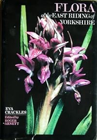
cover image of the Flora of the East Riding of Yorkshire
Her major work, the Flora of the East Riding of Yorkshire, was published by the University of Hull press in 1990.  This represented over 40 years work by Eva and many other enthusiastic local natural historians (many of them introduced to the subject by Eva, who as Vice-County recorder for the Botanical Society of the British Isles for East Yorkshire ensured that the highest of taxonomic standards were upheld in the area), and contains many maps produced by members of what was then the Geography department showing not just plant distributions but their relationships to the physical geography of the county.  This book is still a very important resource for amateur and professional ecologists alike.


photo of Dr Eva Crackles
Dr Eva Crackles receiving her honorary degree and at work at home, in the early 1990s


Eva's contribution to natural history extended well beyond her own published work.  She was also a major contributor in what we might now call "outreach", both as an active member of organisations such as the Hull Scientific and Field Naturalists’ Club and the Yorkshire Naturalists’ Union, through teaching evening classes for the Workers’ Educational Association and via writing the Crackles Country column for the Hull Daily Mail.  Becoming largely wheelchair bound in later life did not stop her enthusiasm for field work; her obituary in the Linnaean Society Journal Watsonia was written by her "honorary wheelchair-pusher", Peter Cook, who accompanied her on many field visits.  Her scientific contributions, her lifetime of teaching and her major contributions to natural history were recognised by an honorary doctorate from the University of Hull in 1991 and an MBE in 1992.

On her death on July 14th 2007, she left generous bequests to both the University of Hull and the Yorkshire Wildlife Trust.  The bequest to the University supported the "Crackles Bequest Project" (2010-2013), investigating relationships between plants and climate across northern Europe, on which Jane Bunting was the academic lead and Michelle Farrell the post-doctoral researcher, and we will be blogging about the findings here as we write them up, taking extra care with our taxonomy in honour of Eva's lasting contribution to generations of Yorkshire natural historians, to biogeography as a discipline, and to the University of Hull.


International Women's Day (8 March) is a global day celebrating the economic, political and social achievements of women past, present and future. International Women's Day celebrates women's success, and reminds of inequities still to be redressed. The origins of IWD can be traced to the struggle for women to gain the vote in European countries about a century ago. The first International Women's Day event was run in 1911


Tuesday, 10 March 2015

WOW Week of Women in GEES: Lynne Frostick


Today, our WOW blog features Lynne Frostick, chartered geologist and Professor of Physical Geography here in GEES at Hull. Lynne first studied at the University of Leicester for a BSc Geology degree, before moving to the University of East Anglia to complete her PhD on “Sediment Studies in the Deben Estuary, Suffolk, England”. This began an esteemed career in Sedimentology which saw Lynne take a Senior Lecturer role at Royal Holloway, University of London and the University of Reading before joining the University of Hull in 1996.


Lynne’s research focuses on two of the major environmental problems faced today: water and waste. Sedimentology has been a core part of this research, particularly sediment and flow dynamics in rivers and estuaries. In this sense, Lynne is perfectly placed at Hull! Lynne also spent a considerable time in Africa investigating the relationship between river development and tectonics. Lynne has always combined field work and modelling, which culminated in the development of the unique Total Environment Simulator – a large physical modelling flume housed in The DEEP aquarium on the banks of the Humber Estuary. This world-class facility is a career highlight for Lynne. “The work I am most proud of is always the most recent. I am very proud of the Deep flume and leading work on ecohydraulics, particularly the Users Guide to Ecohydraulic Modelling and Experimentation”. Over the last few years, Lynne has also used her expertise to address issues surrounding waste, working in research fields as far reaching as biology, chemistry, microchip technology, regulation and policy.

Lynne and Stuart McLelland setting up an experiment at the TES, The Deep (Photo: http://discoverarmfield.com/en)
Lynne’s work has always had strong links with industry and policy. Whilst at Hull, she began a Centre for Waste and Pollution Research at the University which then evolved into the Environmental Technologies Centre for Industrial Collaboration. Lynne’s research is of particular importance to locations such as Hull, as it often strived to understand flooding and coastal management.  She was a leading member of the 2007 independent Hull Flood Review Group and was a member of the North East Regional Environmental Protection Advisory Committee. This has led to Lynne’s recent appointment (16th March 2015 for three years) to the Board of the Environment Agency as lead member for flood and coastal risk management.

This latest appointment is added to a long list of prestigious positions and awards which have honoured Lynne’s achievements. Lynne was the Pro Vice Chancellor for research at Hull (1999-2004), she followed in the footsteps of Darwin to hold the post of the Honorary Secretary to the Geological Society in 1988 (the first woman to hold this role) and then later in 2008 she became the society’s President. Lynne was the 2nd woman to hold this role, and the last to date. At the same time, Lynne became the chair for the British Society for Geomorphology. In 2005, the Royal Geographical Society awarded her with the Cuthbert Peek Award “for advancing the application of physical modelling to environmental problems”. Most recently, in July 2014, Royal Holloway awarded Lynne with an Honorary Doctorate for services and leadership in British Geology.

Lynne’s biggest challenge in her career was “definitely juggling family and career. I had my kids very late- between ages 40 and 44- and having 3 boys under 4 years and a full time academic career was a real challenge! It is a good job I have a supportive husband”. A supportive husband and a good mentor it seems – her advice to (young) GEES women is to “have confidence in yourself and your abilities” but also to get a good mentor. “Mine was Janet Watson and she was terrific”. Lynne is also a leading voice for women in science careers. She is a member of the Government’s Science for Careers Group, was the chair for the Government’s Expert Group for Women in STEM, and has been a trustee of The Daphne Jackson Trust (a scheme to help STEM women who’ve taken a career break to raise a family). In 2009 she was a recipient of UKRC Outstanding Women of Achievement Award for SET Leadership and Inspiration to Others. Now Professor Emerita, Lynne continues to be an active board member and continuing to do research, and can often be found giving talks about why we need women scientists and engineers.


International Women's Day (8 March) is a global day celebrating the economic, political and social achievements of women past, present and future. International Women's Day celebrates women's success, and reminds of inequities still to be redressed. The origins of IWD can be traced to the struggle for women to gain the vote in European countries about a century ago. The first International Women's Day event was run in 1911

Monday, 9 March 2015

WOW Week of Women in GEES: Jacqueline Burgess


Guest blog by Dr Sally Eden.

To celebrate International Women’s Day, this week we celebrate notable women who have worked in or contributed to the GEES Department at Hull since its foundation. We are lucky that we have more women than ever before on the teaching staff now, so each weekday this week, we will highlight women’s achievements in GEES and remind ourselves how important women are as staff and students in this Department and this University. We wish there were more women we could pull into the limelight, but the process of putting together this blog series emphasised to us the the rather masculine histories of our Department and our University, histories that we need to continually challenge, as well as actively encouraging and supporting those women who are moving Geography and the University forward today.

To kick off our WOW: Week of Women in GEES, we start with Jacqueline Burgess. Jacquie began her academic career here in Hull, first as an undergraduate and then as a postgraduate student in the Department of Geography. She completed a PhD in 1975 entitled The meaning of place: a study of geographical imagery with particular reference to Kingston upon Hull. For her, Hull was not only the location of her studies, but also the subject of them, as she began to shape the developing subdiscipline of cultural geography.

She then moved to the Department of Geography at University College London in 1975, becoming their first female Professor in 1998 – remarkable to realise that this ‘first’ occurred only 17 years ago! In 2006, she moved to the School of Environmental Sciences at UEA, becoming their Head of School.

A key figure in environmental geography, Jacquie set the agenda for applying insights from cultural geography to environmental perception and policy making, as well as critiquing economic models of environmental valuation and behaviour change. She helped found the Landscape Research Group, which she chaired through the 1990s, and championed qualitative methods, such as in-depth discussion groups and developing deliberative, participatory environmental decision-making processes, helping to make such methods widely accepted.

Jacquie’s research has always been highly policy-relevant and she has contributed to the work of key national organisations such as English Nature, Countryside Commission, Countryside Agency, and the Environment Agency. In the early 2000s, she chaired the Board of Global Action Plan, a national charity committed to helping individuals and organisations develop more environmentally-sustainable practices.  She also led the assessment of the ‘cultural services’ of nature by the UK National Ecosystem Assessment Expert Panel (2008-10).

After retiring from academia in 2010, Jacquie joined the Norfolk and Suffolk Broads Authority in 2012, becoming Vice-Chair in 2013 and continuing to shape the geography of that very culturally important landscape.  


InternationalWomen's Day (8 March) is a global day celebrating the economic, political and social achievements of women past, present and future. International Women's Day celebrates women's success, and reminds of inequities still to be redressed. The origins of IWD can be traced to the struggle for women to gain the vote in European countries about a century ago. The first International Women's Day event was run in 1911


Wednesday, 4 March 2015

Storm Surge 2013 : One Year On - Part Four : Spurn

by @cloudskinner

This is the fourth and final installment of our mini-series looking back over the year since the 5 December 2013 storm surge, which flooded many areas in the Humber Estuary and along the east coast of the UK. The first part, Modelling the Surge, looked at the research that has been conducted since the storm surge and has advanced our knowledge and understanding of these events in the Humber. Part Two, What we Learntfocused on the 2014 Humber Conference and the lessons that have been learnt over the year. Last week guest blogger, Jazmin Scarlett, told us about some of the often unseen impacts of flooding, the mental health issues that can arise, and how communities band together after disasters.

For the final part I want to take a longer look into the future and try and predict what it has in store for Spurn. Spurn, or Spurn Point as it is commonly known, is a piece of land that resembles a spit, sweeping out from the edge of the Holderness Coast and round into the estuary. It is important for several reasons: it hosts the signalling station for the Association of British Ports (ABP), kind of an air traffic control but for shipping; it is home to lifeboat crews (formerly permanently, with their families, but now just the crews whilst on shift), providing them quick and easy access to the North Sea and the estuary; it is an important site for migrating bird life, being a National Nature Reserve owned by Yorkshire Wildlife Trust; it keeps the mouth of the estuary narrow – it is not known what effect a wider mouth would have but it is expected that it could lead to a narrower channel with implications for shipping; and finally, it acts to guard the estuary from the full ravages of storms and waves.

When evaluating the true impact of the 5 December 2013 storm surge one cannot ignore Spurn. One of the most dramatic scenes from that night was the damage done to the landform, as highlighted in the LiDAR images below.


The breach at Spurn as shown by LiDAR data. Light Detection and Ranging (LiDAR) techniques uses rapid pulses of laser light to measure the elevation of the ground, both rapidly and in high detail. The top image shows the breached section of Spurn before 2013, and bottom image shows the same section measured shortly after the 5 December 2013 event 
(LiDAR data collected and provided by the Environment Agency).

It is clear that extensive damage was done by the waves and high water levels during the storm surge. The water will have over topped the narrow spit of land that separates the sea from the estuary, and washed the embankment down towards the estuary – you can see in the image that the bank has gone, and a mound of material has built to the left, on the estuary side.

There once was a road here at the breach site 
(author's own photo taken November 2014)

To understand the implications of this, and what the future might be, we need to delve into the past of Spurn. There are two theories behind the formation of Spurn which have emerged from two former University of Hull academics -
  1. George de Boer long maintained that Spurn was a spit – material eroded from the Holderness Coast washes down via longshore drift, and is deposited as a long spit in the form of Spurn. Over time as the coast line retreats, this spit will be rapidly destroyed and another will form further back in line with the coast.
  2. John Pethick disagreed however – He argued that Spurn was not a spit as such and had not retreated over time through repeated cycles of destruction. Rather, the end of Spurn is an island and had been in a fixed position throughout history, whilst the area between the island and coast is in a constant state of flux, sometimes forming a spit, sometimes a chain of islands and sometime open channel and sand banks. Although the location of this region has shifted over time with the coast, the end of Spurn has remained.
Until the 2013 storm surge both these theories were just academic. In his chapter of Neale and Flenley’s 1981 book, ‘The Quaternary in Britain’, de Boer recounts the recent history of Spurn and tells a tale of how it became a very man-made feature. He claimed that a cycle of destruction was taking hold in 1849, initiated by a violent storm (probably not unlike 5 December), and within a few years several wide and deep breaches formed along the narrow spit as it were then.

Water at high tide washing over the breached section of Spurn 
(author's own photo taken in November 2014)

In response, and to maintain the lighthouse and lifeboat crews housed there, the government at the time funded works to fill the breaches and huge loads of chalk from Barton-upon-Humber were dumped into the channels to fill them. Spurn came into the hands of the military and prior to WW1 the defences were bolstered and groynes put in place to let the spit grow. During both World Wars Spurn played an important role, not least in monitoring for possible enemy U-Boats infiltrating the estuary. It even had a railway line until 1951, and withstood the infamous 1953 storm surge with little damage.

In the 1960’s Spurn passed from military hands into the Yorkshire Naturalist’s Trust and eventually Yorkshire Wildlife Trust’s ownership, and the focus shifted from maintaining the hard, man-made structures of Spurn to the conservation of its environment and wildlife – as such the investment and work done to retain the defences has significantly decreased. I am sure George de Boer, if he were alive today, would suggest that the breach is the beginning of the cyclic destruction of Spurn that was stalled in the 1840’s.

View across the full breached section 
(author's own photo taken in November 2014)

I’m more inclined to side with John Pethick, however. Even if we were to just let nature take its course, I cannot envisage Spurn being utterly destroyed and replaced further into the estuary, nor do I think the evidence is strong for that having happened in the past, but it is clear that without huge investment to rebuild the spit as it were before 5 December, the nature of Spurn is going to change and will be in flux.

To predict what will happen to Spurn in the future, as the Holderness Coast retreats further back and sea levels rise, we need to adapt our models to be able to simulate some of these scenarios. Equally, it is important that we turn again the research of George de Boer and John Pethick, dig even further and try to understand the nature of Spurn; what it is, how it formed and how it has changed naturally in the past. Understanding that is the key to understanding its future.

Thanks to the Environment Agency and the Geomatics Team for the provision of LiDAR data used in this blog. This data was provided to University of Hull as part of the Dynamic Humber Project.

de Boer, G., 1981. Spurn Point : Erosion and Protection after 1849. IN: Neale, J., and Flenley, J., (eds). The Quaternary of Britain : Essays, reviews and original works on the Quaternary published in honour of Lewis Penny on his retirement. Pages 206 - 215. Pergamon Press, Oxford.